Introduction

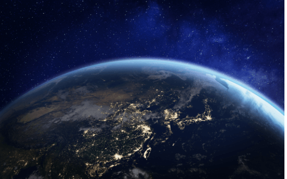
Asia at night from space with city lights showing human activity.
By NicoElNino, Getty Images Pro via https://www.canva.com
Globes can be really fascinating for people of all ages, especially for those who love travelling and stories from far-away countries. The earliest known globe of the Earth was created by Crates of Mallus, a Greek Stoic philosopher of the 2nd century BC, while the oldest surviving terrestrial globe was constructed by Martin Behaim in 1492 and belongs to the collection of the German National Museum.
Moving fast-forward in time, we come to 2005, when Google launches a satellite imagery-based mapping service, known today as one of the world's most comprehensive 3D maps. “Google Earth” is a geospatial software application that displays a virtual globe, offering the ability to analyse and capture geographical data. Nevertheless, it can offer so much more than a static picture of the planet.
This quest will help you learn how to create 3D customized maps and connect them with interesting stories about places around the world.
Task

Image by Михаил Руденко.
Getty Images via https://www.canva.com
A globe is the truest representation of the Earth; a map imprinted on an orb/round ball in the shape of our planet. Whether antique or contemporary, but even much more when they are digital, globes can help us connect to the world, rethink our place in it and feel the magic. Your task, as a young journalist or filmmaker is to use the available Google Earth creation tools to bring the Virtual Spitfire’s travel to life and share your 3D story-project with the world!
Process
You will need a computer, a Chrome browser, a Google Account, the details you want to include about the places you visited, as well as any photos and online videos you want to use.
Recall as many as you can from the notable and iconic landmarks and monuments that you visited during your virtual flight to France, Sweden, Greece and the UK. You can use the information you already learned and/or search for even more interesting facts and audio-visual material about these places. You can also use screenshots that you took during the Spitfire’s flight!
The weblinks with detailed instructions and related videos provided in the resources section are most of the times available in multiple languages and will guide you on how to complete your “Virtual Spitfire - Google Earth Project”.
You will learn step-by-step how to create a new project, mark the spots you want and add text, photos, and videos to create an interesting story. You will also learn how to share your maps and stories with others to collaborate. After completing your project you are more than welcome to share it with us either via e-mail or via Facebook (tag us @virtual.spitfire).
Conclusion
Google Earth has facilitated many people, institutions and organizations to stay connected to the world in a very immersive way, especially during the last year that we have all been “stuck at home” due to the Covid-19. Google Earth can be used for purposes such as research, education, film and non-profit use without needing permission and can broaden our world view, helping us stay curious, creative and empathetic.
Evaluation
- This quest combines the Virtual Spitfires’ journey with the use of Google Earth to encourage exploration, investigation and engagement.
- Learners are enabled to “read” maps and strengthen their geospatial thinking.
- They also expand their knowledge about their own country and other countries as well.
- Participants will create and share a 3D project inspired by the Virtual Spitfire’s journey.
- Learners reflect upon their own place in the world.


